Categories
Category: Gear & Stuff
Categories
Silenced FN 45
Categories
Toyota Must hate this ad

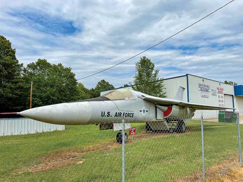
Turner’s Army Surplus is tough to miss. There is a gigantic Air Force jet parked outside.
Recently, while driving from Mississippi to Dallas, Texas, I passed a real-live dinosaur on the side of the road. Right outside Texarkana, on the right heading south, there rests a derelict F-111 fighter/bomber. It’s tough to miss. It took a little maneuvering to find the right off-ramp, but I soon found myself standing before Turner’s Army Surplus. This deep into the Information Age, I thought Army Surplus stores had gone extinct. As I pushed into the dimly lit place, I was transported to a better time.
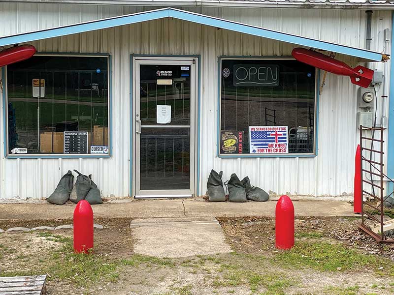
The storefront should look familiar to any self-respecting gun nerd above a certain age.
An Endangered Species
I grew up in a small town in Mississippi. Our commercial and social opportunities were limited, but I neither knew any better nor cared. I had a family that loved me and a rudimentary starter gun collection. Life was good.
One of the high points of visiting my grandparents down in Hattiesburg was Sack’s Army Store. Sack’s was located downtown and was a fairly high-brow establishment. In addition to the obligatory GI-surplus uniforms and field gear, they also carried commercial camping kit and survival supplies. Even now, some four decades later, I still have stuff that I bought there.
The archetypal Army Surplus Store, however, was something else entirely. There was a great one in Brandon, Miss. You know the sort I’m talking about. It occupied an unadorned metal building, the exterior of which had been crudely camouflaged with green and brown house paint. The few windows were heavily barred and old surplus Air Force practice bombs set into the ground defined the limits of the parking area. Just thinking about that place conjures a smile.
The interior smelled like a toxic combination of mildew, bug juice, cigarette smoke and feet. Rack after rack of old camouflage fatigues filled the main showroom, such as it was. Crammed haphazardly around the periphery were old combat boots (they never once seemed to have my size), stacks of vintage helmets, musty old sleeping bags and piles of filthy camo nets. Somewhere in the place was always one of those oversized cutaway military training rifles, most commonly a Garand, Carbine, or BAR.
The place in Brandon was run by a chain-smoking Vietnam vet who only rarely acknowledged my presence. He occupied his time burning coffin nails while glued to a 12″ portable TV. I swear, one time I went in there, the guy was watching an aerobic exercise program.
This store actually had a few guns. There were always a handful of vintage GI bolt action rifles along with an SKS or three. As this was the Deep South and formerly a war zone, there was typically a smattering of Civil War pieces as well. I recall drooling over a beat-up old Colt Navy that was way outside my price range.
I loved those old places. In my mind, every helmet dent was a ricocheted round, and the old guy would indeed tell you war stories if you sat down long enough to listen. Alas, I thought they were all gone by now. The proprietors fell prey to emphysema and heart disease, while the stores succumbed to the Internet and eBay.
Visiting Turner’s Army Surplus is to glimpse a better time.
Turner’s Army Surplus
That is what made my serendipitous find alongside the highway in Texarkana such a treat. Turner’s Army Surplus was like a time capsule. Dropping by brought back all those epic memories from my childhood.
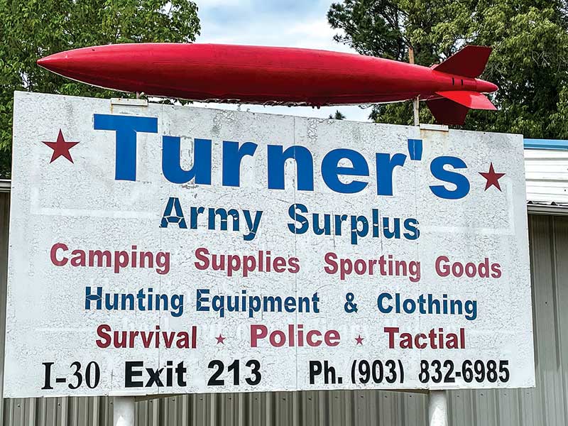
For starters, part of the sign is misspelled, and I love that. What should say “Tactical” is actually spelled “Tactial.” A piece of 8.5″x11″ paper taped inside the front door says simply, “Smile, Jesus Loves You,” and is undeniably sincere. Another notice posted on the surrounding chain-link fence seems comparably genuine and states, “Are You Going to Listen to Me in English, or Do I Have to Speak to You in 12-Gauge?” This placard includes a graphic depiction of a pump-action 12-bore for emphasis.
Turner’s sports that same intoxicating Army surplus smell along with a fantastic array of tantalizing cool-guy stuff. In addition to the massive strike fighter parked outside, the nearby barn/shed contains a couple of beautifully restored vintage jeeps. Practice bombs and empty artillery shells litter the grounds.
In addition to the surplus gear for sale, Turner’s also includes a walk-through museum. This bit is adorned with interesting memorabilia obviously collected over decades. You can take it in over perhaps half an hour and will be glad you did. The staff is predictably friendly, as are most gun folk.
Lots of people trek up or down I-30 en route to someplace or other. If ever you need to stretch your legs around Texarkana, then Turner’s Army Surplus and Museum is definitely worth the stop. It’s at Exit 213. You can’t miss it. Just look for the massive swing-wing attack plane parked outside.
Categories
Luger Snail Drums